GIS application

what is GIS?
GIS (Geographic Information System) is an information system that uses computer software and hardware to assist users in processing digital geographic data.
How to use GIS?
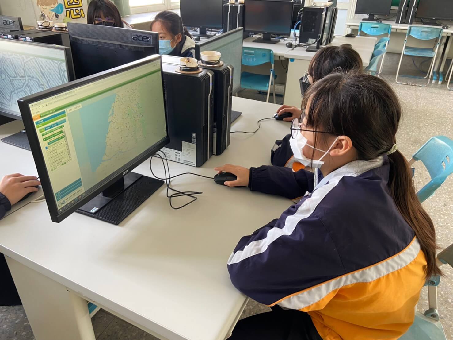
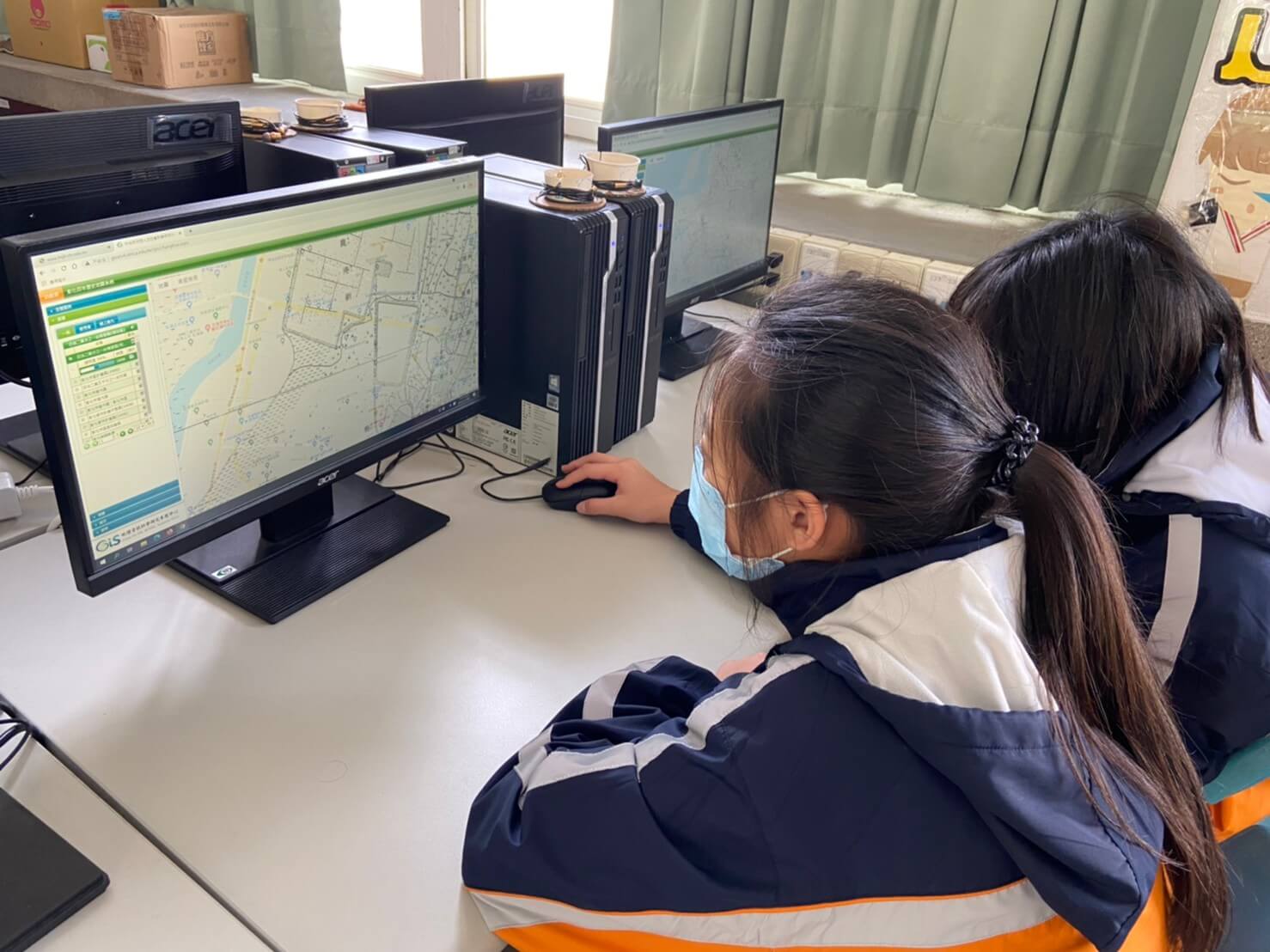
Taiwan Centennial Historical Map System
It is an application combining GIS (Geographic Information System) with historical research data.
Through this system, users can arbitrarily select 2 to 3 layers for overlapping, and set different transparency for each layer, so that they can easily perform map overlapping and comparison operations between different periods, and master the basic information of environmental changes in Taiwan over the past century.
Taiwan Centennial Historical Map System- LINKIn order to better understand the changes of Lukang over the past century,
we compare the past and present
through “Taiwan Centennial Historical Map System”.
How to operate :
[Layer]->[General],
click the [1/20,000 Taiwan Fort Map during the Japanese rule in 1898] layerReference map legend
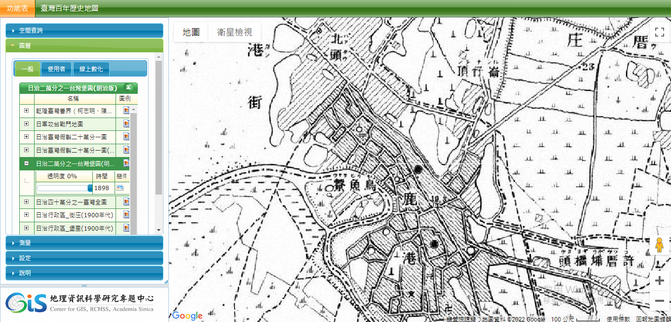
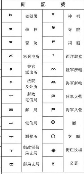
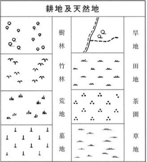
Use the transparency function, refer to the legend,
and compare the present with the past.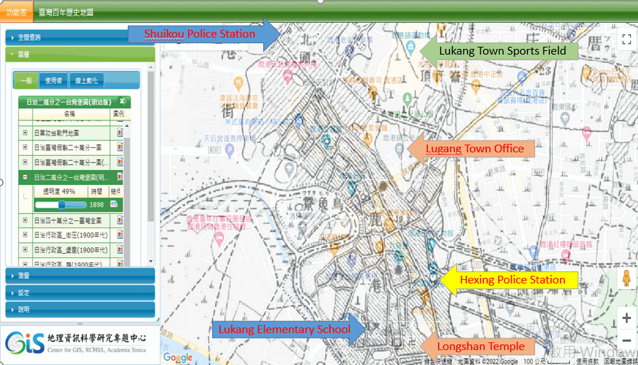
The results show that......
1 Lukang Town Sports Field & Lugang Town Office were cemetery in 1898. 2 Lukang Elementary School is indeed a school with more than 100 years of history. 3 The earliest police station established in Lukang area is the Shuikou Police station(水上口派出所).
The police station no longer exists and the building has been demolished.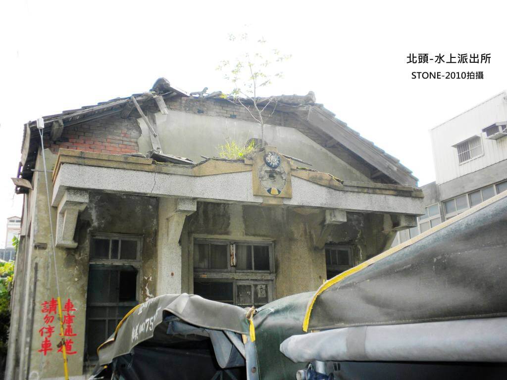
Shuikou Police station(水上口派出所) Ruined but not yet demolished in 2010
photo source
4 Hexing Police Station was once used as the Lukang Branch Office under the Taichung Department ??
But we can't be sure, we haven't found relevant information to prove it.
How to operate :
[Layer]->[General],
click the [1/25,000 Taiwan Fort Map during the Japanese rule in 1921] layer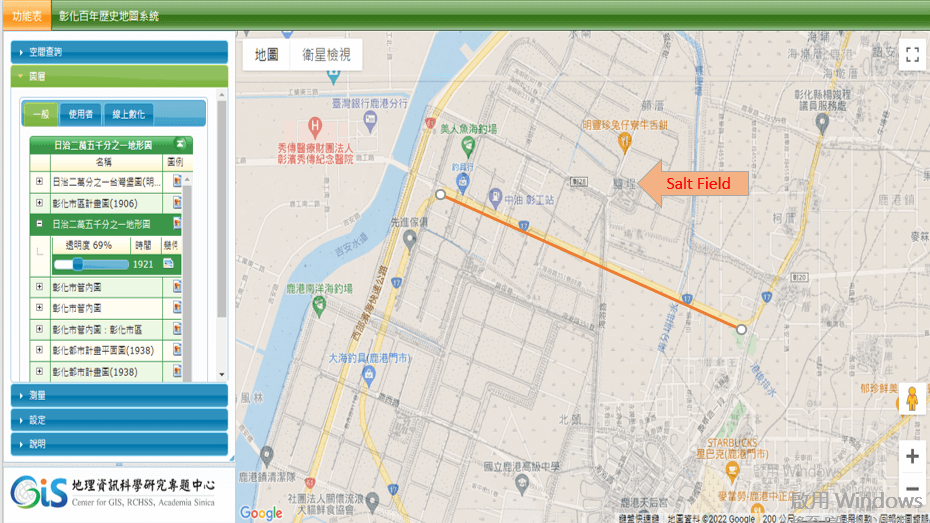
The results show that......
The large salt field area north of Route 17 is marked as "Salt Field" in Google Maps, proving that this area was the earliest developed salt field area.

© 2022 Lu Ming junior high school-Lu Ming Hexing Team
All Right Reserved.