|
※Master Weather Talk -- Changeful Clouds
Student:We often see many cloud layers in the sky, but we don’t know what are these clouds called and when do they usually appear?I want to ask master, what is the most common cloud layers?And their names?
Master:Cloud layers in the sky like us people have their own names. Clouds like humans too would show up during a particular period. Different clouds appear in different seasons!Which season do you like to know? Student:Can you tell us which clouds appear in which season, and their names? Master:Of course!Let me introduce them to you! |
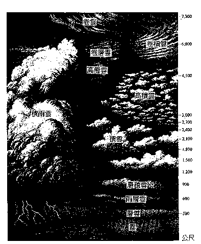
Relative altitudes of cloud layers
|
The following are various cloud layers explained by the master(please click the headings below)
●Low Level (below 6500 ft)
|
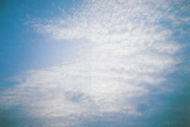
Stratus usually appears:below 2000 m.
Stratus is low level grey to white cloud with a uniform base. This cloud is essentially above-ground fog. It is often featureless, but does not stay on the ground. It usually stays as low as mountainsides with its edge around the mountain peak. When it gets there, it’s thick fog. Stratus may fall light rain, and light snow in winter. It does not last very long, about a few hours. When Stratus is dispersed by the wind, forms irregular fragments, it is called Stratus fractus(it usually appears grey or grayish white, and indicates sunny day when it shows up). |
Stratus
|
|
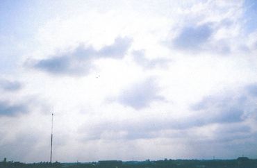
Nimbostratus usually appears:below 1500 m.
This is a classic bad weather cloud that produces continuous bad weather. It is dark grey, featureless, dark and amorphous like a piece of cloth. The sky would turn dark because of it. Continuous rain must come from nimbostratus. It produces continuous rain (snow), or falls as virga, messy bottom and shapeless. Cloud layer is thick, the lower section is composed of droplets, middle is composed of droplets and ice crystals, upper is ice crystals section. Most are ice-water mixed hybrid clouds. Its peak usually reaches above 6000 m. If nimbostratus spreads across the sky, it means rain drops in 4 hours, and lasts for a few hours. |
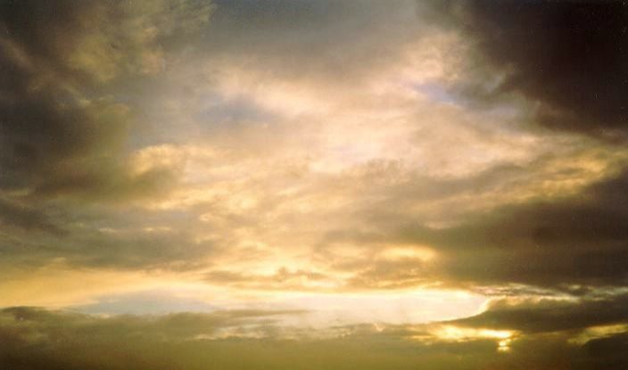
Nimbostratus
|
|
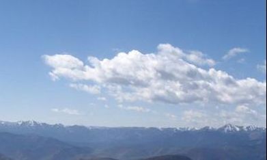
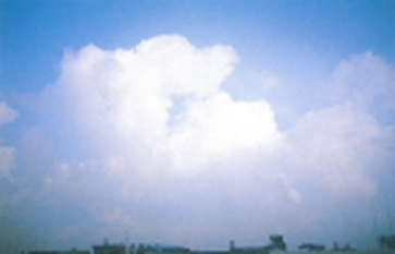
Cumulus usually appears:around 5000 m.
Cumulus often appears in summer, shaped like cotton, cauliflower with flat bases. An entire piece spreads across the sky. Its peak uplifts like mound, cauliflower or tower. When sunlight slants on cumulus, it has clear bright and dark sides. If it’s in the same direction as sunlight, middle section is dark and periphery is extra bright. After cloud temperature rises, this cloud would evaporate and disappear. Cumulus usually appears in sunny day, but when its peak grows into ice atmosphere, precipitation could happen. Light shower or snow depends on surface temperature. |
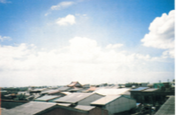
Cumulus
|
|
Stratocumulus usually appears:around 6500 m.
The dispersed advectional currents in the sky create stratocumulus. We can see this cloud very often in the sky. It does not appear very thick. The individual elements are larger than altocumulus, more soft and featureless. It has wavy shape bases and striped grey shadows when forms in lines. Most stratocumulus is like a huge roll. Below the cloud base is vortex layer. A sea of clouds seen from the mountain is mostly stratocumulus cloud. In other words, the peak of this cloud looks like “sea.” |
Stratocumulus
|
|
Cumulonimbus usually appears:around 3000 m. When it develops into big one, could be extended from 2000 m to as high as 10000 m across the entire cloud layer.
The largest of all clouds, when vertically developed, it can extend through all three cloud regions. It has dark base which is hard to distinguish. Its peak uplifts like mountain or tower. Anvil-like cirrus nothus extends like a huge feather fan. Near its base is ragged low cloud. Mixing with each other, the base can reach the standard of cumulus. This cloud can produce strong convective currents, rain sometimes appears in “fallstreaks” form. It develops quickly and produces torrential rain, lightning. However, this cloud does not last very long. |
Cumulonimbus
|
●Medium Level (6500 to 20000 ft)
|
Altocumulus usually appears at:around 8000 m.
Higher altitude stratocumulus cloud, we can usually see the pod-shaped altocumulus in high altitude mountain area because convective current and high-altitude current blow in turns. The individual elements are larger than cirrocumulus, middle has cloud shadows. It usually appears in line across the sky or sometimes spreads individually. It has wavy or flat base. Sometimes it can be hard to distinguish when it mixes with thicker cirrocumulus. This cloud appears in many shapes such as a long line, chessboard, a herd of sheep, sheets of mica, pods or cottons. |
Altocumulus
|
|
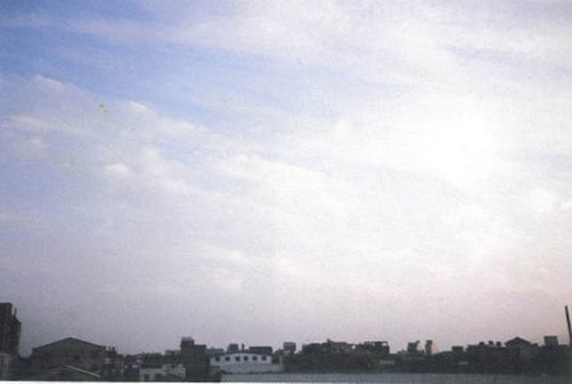
Altostratus usually appears:below 8500 m.
Altostratus usually blocks the entire sky. When it appears thinner, sunlight or moonlight can penetrate cloud layer and produce “sun halo” or “moon halo.” When it appears thicker and lower, it gives a dark impression. Before it turns into nimbostratus, light rains drop. When it moves lower, it would change into nimbostratus, the weather turns bad. On the contrary, nimbostratus can turn into altostratus when rises. |
Altostratus
|
●High Level (above 20000 ft)
|
Cirrocumulus usually appears at:around 9500 m.
This cloud rarely appears and usually forms in patches and fish scale shape. When it spreads across the sky, fishermen call it “tuna day” because the sky looks like full of fish scales. They are very small, and appear as white and without shading. Sometimes they appear as wave shapes. When sun or moon is blocked, it can easily produce “corona.” Cirrocumulus usually appears with cirrus and cirrostratus across the sky. When they show up, it is usually a sign for good weather. |
Cirrocumulus
|
|
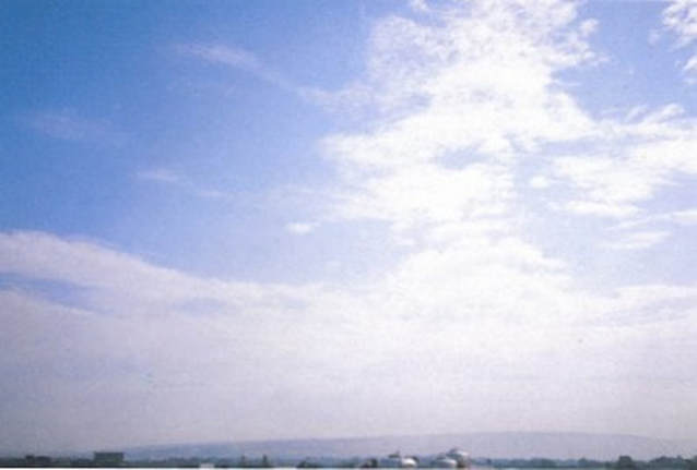
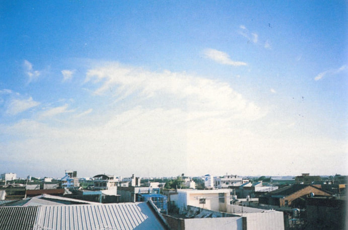
Cirrostratus usually appears at :around 10500 m.
It is a high-level, very thin type of cloud, composed of fibrous textures, and usually spread across the sky. When sun or moon is blocked, sunlight or moonlight can still shine through, and we can see its shape. It is capable of forming halos, sun halo or moon halo, and the most common one is 22° halo. Halo is an optical phenomena with not so conspicuous colors. Inner circle is red and outer circle is purple. It is the refraction when sun or moon shines through cirrostratus. When halo appears in the sky, there must be cirrostratus;however, think cirrostratus can extend across the sky without halos. |
Cirrostratus
|
|
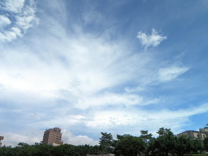
Cirrus usually appears:above 11000 m.
This is a genus of clouds generally characterized by thin, wispy strands, fiber tissues like feathers, hairs, filaments or ponytails, etc many shapes:high in the sky and do not cast shadows:red or orange-red during sunrise and sunset. Cirrus cloud is the highest cloud. Early in the morning, sunlight reaches it before the horizon. It is also the highest cloud, and it has thin, fiber tissue like shapes which look a lot like feathers or cotton wadding. Cirrus clouds have thick range and are composed of ice crystals. Sunlight shines on this cloud during sunrise or sunset with beautiful glows. |
Cirrus
|
Texts:Team Pika, Wikipedia Taiwan, Weather in Taiwan
Pictures:Weather in Taiwan, Wikipedia Taiwan, Central Weather Bureau
Pictures:Weather in Taiwan, Wikipedia Taiwan, Central Weather Bureau