


 |
 
 |
|
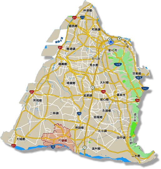
》Chutang Township Location |
"Chutang Township" is located in the southwest of Changhua
County, adjacent to Sijhou
Township and Pitou Township in
the east, Tacheng Township in
the west, Erlin Town in the
north, and Zhuoshuixi River in
the south. It is divided into Yunlin
County. 14 villages, 183 neighbors.
|
 |
 |
|
Township location map(Source:
Google map) |
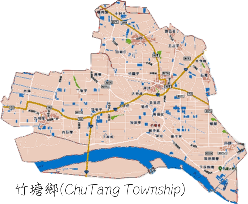
ChuTang administrative
area(Source:
Google map) |
ChuTang Township is
located at the southernmost tip of Changhua County. It is bounded
by Zhuoshuixi River and
Yunlin County. The whole
township is the alluvial plain of
Zhuoshuixi River. The soil is fertile, the climate is mild,
the rainfall is moderate, the agricultural production conditions
are extremely excellent, and the production of agricultural
products is a Typical agriculture-based towns and villages; not
only from the sea, but also the benefits of turbid water
irrigation, since ancient times is the richest place of rice,
producing a well-known "Zhuoshui
Rice", known as "Changhua County barn" deserved.
In recent years, due to overproduction of domestic food
crops and the opening of rice imports by the government after
joining the “WTO” (World Trade Organization), rice prices are
becoming cheaper. Many farmers have undergone agricultural
transformation and upgrading, and have planted other cash crops,
traditional rice fields. Throughout the land, the landscape has
also changed, forming a new look of rural crops.
With such a geographical advantage of "Wind tail Water
source", ChuTang Township
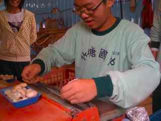
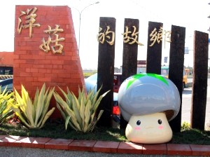
produces a variety of agricultural products, such as Rice noodles,
Eggs, Mushrooms, Golden grapes, Burdock tea, peas, Sand pears,
etc. All are local agricultural features.
|
|
 |
 |
2009 Works「Baby mushroom」
(Source:
Self-shooting) |
Hometown of mushrooms
(Source:
Self-shooting) |
Rice flour promoting
(Source:Taiwan
good news site) |
》Transportation mode
The transportation is mainly based on road transportation.
The main transportation methods are as follows:
◎Highway
>Provincial Highway 19 Line (Central Highway):
Pitou Township→
ChuTang Township→
Erlun Township,
Yunlin
County.
※Important north-south roads, north to
Pitou Township,
Changhua City, south to
Yunlin County
Erlun
Township.
>No. 145, County Road, County Road: Located at the border (Tiantou
Village), Pitou Township→
ChuTang
Township→ Pitou
Township.
>No. 152, County Road (Dongyang
Road, Xilin Road):
Tacheng Township→
ChuTang Township→
Pitou
Township
※Important road for East-West direction, go west to arrive the
Tacheng Township, after going
east
through Pitou
Township, take the Sijhou Road,
pass the No. 1 National Road via the
Beidou Interchange,
and continue to the
Sijhou Township and Ershui
Township. Nantou County and
Other towns.
◎Intercity Bus
>United
Highway Bus:
1630 Taipei←→Xigang(Stop at Jiukuaicuo、ChuTang)
>Yuanlin Bus:
6707 Yuanlin←→Erlin
◎Changhua County Bus:
>5way DRTS demand reaction bus
|
|
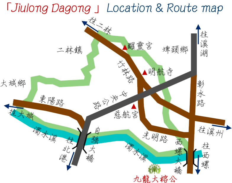
》Finding the「Jiulong Dashugong」 |
※ Transportation mode:Recommended to drive or plan a bicycle trip。
※Way of arrival via national highway(About 15 minutes by car):
National Road No. 1: Beidou
Interchange
↓
Go to the northwest of Douyuan
Road 2nd section → 150nd County Road,
Chaoxi Road, 2nd section, continue on the 150 County Road:
3 minutes (1.2 km)
↓
Go to Section 2, Zhongshan Road,
Sijhou Township → Longitudinal
Road → Taiwan Line 1: 6 minutes (4.4 km)
↓
Along the Longitudinal Highway → Tai Line 1 and 145 County Road to
Tiantou embankment in
Pitou Township: 6 minutes (4.6
km)
↓
At Tiantou embankment turns
left, destination is on the left: 2 minutes (1.4 km)
↓
Jiulong Dashugonog(Symbol::23.828986°N 120.449028°E)
[Use Google Map to map the best path as
a reference]
|
 |
 |
|
Jiulong Dashugong Location & Route map(source:Self-edited) |
Route planning(source:Google map) |
 |
|