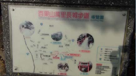
| Baiguo Mt. Hiking Trail | Four Seasons of trails | Features of trails |
| Greatwall Hiking Trail | Sibaikan trail | Tengshan Hiking Trail | Longding Ancient Path | Liangbaikan Trail |
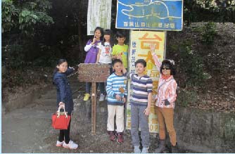
About Sibaikan Trail:
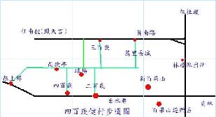
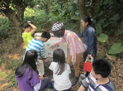
Sibaikan Trail is located in Baiguo Mt., and can be accessed from Chushui Lane or Yuannan Rd., through Shanjiao Rd. (see the map). Sibaikan Trail is the common route where the civilians of Yuanlin Township walk in the morning and evening, there is not only fresh air, but the trail is also full of green all year around, like a green tunnel, and you can always hear the pleasant bird twitters. Climbing to the top “Shangqing Pavilion”, you will have a bird view of the whole urban area of Yuanlin Township, seeing the beautiful scenery, you will be refreshing.
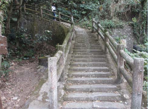
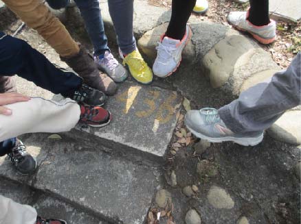
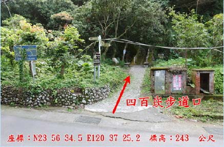
Sibaikan Trail is a cement trail step leading to the top of the mountain, there are totally 436 steps, and the mantissa 36 is eliminated, thus the name “Sibaikan Trail”.
| Greatwall Hiking Trail | Sibaikan trail | Tengshan Hiking Trail | Longding Ancient Path | Liangbaikan Trail |
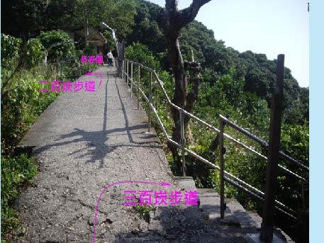
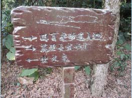
About Liangbaikan Trail, Sanbaikan Trail, Sibaikan Trail:
It is the branch of Baiguo Mt. Greatwall Hiking Trail. The entrances of Liangbaikan Trail and Sibaikan Trail are located at Chushui Lane, while that of Sanbaikan Trail is at Yuannan Rd. All three trail lead to Greatwall Hiking Trail, and are perfect for hiking.
Transportation guide for Liangbaikan Trail, Sanbaikan Trail, Sibaikan Trail:
Go southbound on National Highway No. 1, exit at Taichung Nantun interchange, take Wuquan W. Rd. toward Taichung City direction, turn left on Huanchung Rd., take Nantun 2nd Interchange to get on Chung-Chang Express Highway (Tai No. 74 Line) for southbound, take National Highway No. 3 by Kuaiguan Interchange, take Chung-Tou Expressway (Tai No. 76 Line) at Chunghsing Interchange, after pass Bagua Mt. Tunnel, take Lincu Interchange, turn left on Shanjiao Rd (No. 137 County Expressway) and go southbound, at the first intersection (Yuannan Rd.), turn left toward Yuanlin Sports Park. Parking is available in front of the park.
| Greatwall Hiking Trail | Sibaikan trail | Tengshan Hiking Trail | Longding Ancient Path | Liangbaikan Trail |
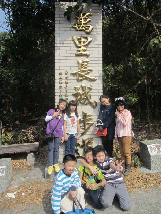
Introduction to Greatwall Hiking Trail:
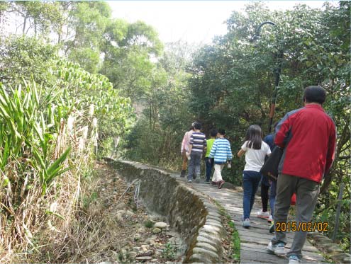
Greatwall Hiking Trail is about 2km in a round trip, with walking
about 80 minutes, along the journey, there is green and fruit trees,
gentle-slope plank road and cobblestone design, usually it attracts
many mountain climbers for hikin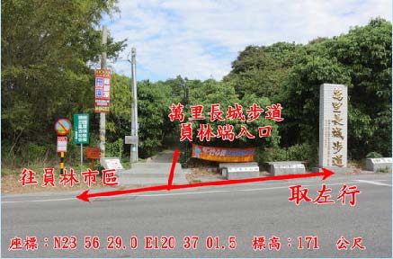 g,
and it is a recreation point famous for fruits and preserved fruits.
g,
and it is a recreation point famous for fruits and preserved fruits.
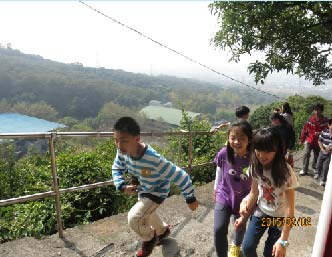
Although it is not high in terrain in the area, there are many trails hidden in it, in which the Dairenkeng Longding Ancient Path has a long history, which was the most convenient mountain climbing mountain for the ancestors to go to Nantou for business, in addition to litchi, carambola orchards, there are also rich animals and plants and natural landscapes for appreciation along the trail. Climbing to the ridge, you will overlook the beautiful scenery and have a panoramic view of the beautiful Changhua Plain.
 Greatwall
Hiking Trail
Traffic Guide:
Greatwall
Hiking Trail
Traffic Guide:
County Line No. 139 ->Lane 1259, Babua Rd. -> Walk for 1 km
till meet the intersection -> Take the right -> at 2.2 km mark, the
entrance is on the left side.
 _________________________________________________________________________________________
| Greatwall Hiking Trail | Sibaikan trail | Tengshan Hiking Trail | Longding Ancient Path | Liangbaikan Trail |
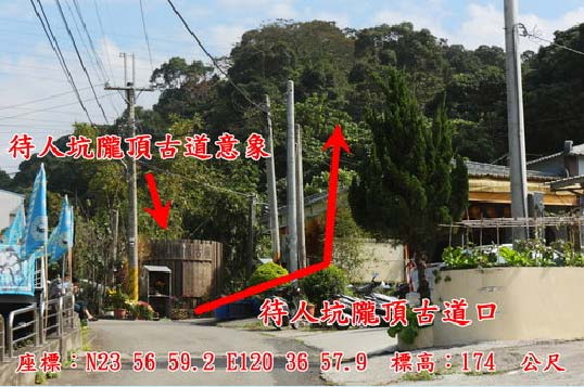
Introduction to Longding Ancient Trail:
Longding Ancient Trail was called “Salt Carrying Ancient Trail”, and now called “Dairenkeng Longding Ancient Trail”, located in Yuanlin Township, adjacent to Zhenxing Neighborhood in the west, Chushui Neighborhood in the south, connecting Dafeng Neighborhood in the north and Nantou City in the east, with a total length of 1.5km, altitude 800m, plank road width 1.2m, and it is also the place where Line 139 passes and the elevated railway crosses. It is quite a convenient hiking route from “Dairenkeng” to Fengshan Temple beside Bagua Road via the Longding Trail in the south.
Overlooked in the far place, Longding Ancient Trail has beautiful scenery. Once being the Baiguo Mt. Chushui Lane drowned by weeds, “Dairenkeng” Longding Ancient Trail shows its appearance of ancient trail upon the rectification of Yuanlin Township Office entrusted by Tri-Mountain National Scenic Area Administration Office. .
Upon planning and rectification by the government, the ancient trail adds the simple entrance image design, there are many ancient trees along the trail, with the elegance of an ancient trail. Bagua Mt. along the trail has rich ecology, and you can also see the transportation cages used to pick up carambola in the early period, and it is a good place for mountain climbing, hiking and leisure in Baiguo Mt.
Longding Ancient Trail
Traffic Guide:
Trail entrance: Hushui Lane, Yuanlin Township->Nantou City Fengshan
Temple
Trail length: about 4km
Walking time: about 50 minutes
_________________________________________________________________________________________________________
| Greatwall Hiking Trail | Sibaikan trail | Tengshan Hiking Trail | Longding Ancient Path | Liangbaikan Trail |
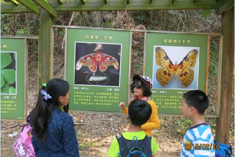
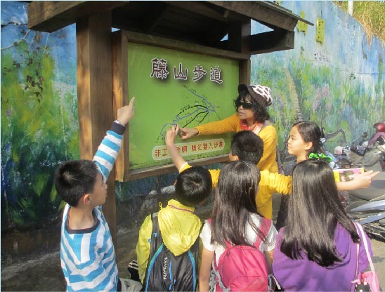
Introduction to Tengshan Hiking
Trail::
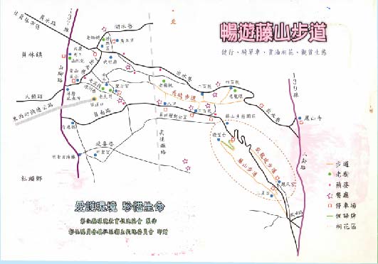
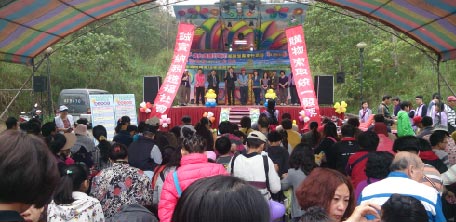
Walking upward from the right path in Tengshanyuan Parking Space, you will arrive at the Tengshan Hiking Trail, which is longer than Wolong Hiking Trail, and is the most popular flower appreciation place during the tung flower. During the season of tung flower, the whole valley is full of tung flowers like snow, very beautiful and it attracts the tourists most. In recent years, Yuanlin Township Office has also held a lot of Hakka tung flower sacrifice celebration activities related with tung flowers through cooperation with the Hakka Affairs Council.
There are 100 interesting Taiwan slangs carved in Tengshan Hiking
Trail, with mixed character board, ecological photo display
gallery, making the tourists perceive the beauty of Taiwan language.
There are viewing decks along the trail, where you can overlook the
mountain scenery and elevated railway, relax your emotion and enjoy
the nature.
The town is one of the bicycle birthplaces in Taiwan, and many
bicycle riders will take Chushui Lane, Hushui Lane, and Tengshan
Hiking Trail as the mountain climbing path in the early training for
several times to exercise their riding ability.
 Tengshan Hiking Trail Traffic Guide:
Go to the south downhill road along Lincuo interchange in the west-east expressway-> turn left to Yuannan Rd.-> walk till the end, and you will arrive at Tengshan Hiking Trail Parking Space.
 __________________________________________________________________________________