The stroy of building the Neopu Mudstone Area Soil and Water Conservation Park:
Intro |
The 921 earthquake struck Taiwan on September 21st, 1999. The act of God urged the central government to conduct a thorough geological survey throughout Taiwan. Since 1998, Soil and Water Conservation Bureau, which is belong to Council of Agriculture, has been devoting its attention to the effectiveness of soil and water conservation, an act of flood prevention at the lower reaches of rivers, the preservation of the scenery, and the promotion of ecological education. However, the results seemed not that satisfying. The challenges are believed to be that the limestone range prevailing in Neopu Village impedes its economic development, soil and water conservation engineering brings ecological destruction, and it does not fit the surrounding scenery.
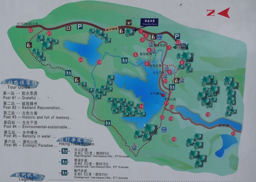
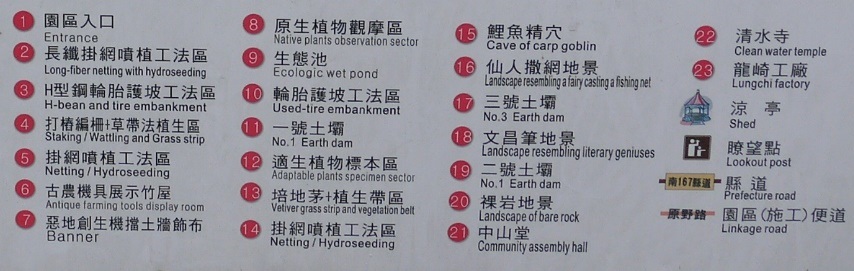
To bear those problems in mind, Council of Agriculture conducted ecological engineering methods at Pi-Zai-Gou River in Longxing Neopu community, Longqi Dist. and introduced integrated watershed management. Taking soil and water conservation, ecological restoration, and leisure space building into its consideration, the authorities conducted ecological engineering methods, hired natives to build dams and embankments, and worked on soil-and-water-conservation project, say vegetation cover. Longqi District Office also built trails and pavilions by the watershed area. What is more, numerous residents volunteered to plant trees along the trail. Residents’ effort turns a moon-surface and desolate landscape into a fertile oasis. It even now serves as an important habitat for many wild plants and animals. Thanks to the amazing result, this watershed was chosen as an ecological engineering methods demonstration area and mudstone soil and water conservation teaching area. |

 |
Well Worth a Visit
After the help of soil and water conservation, these mudstone mountains here became a watershed fulfilling numerous functions, for instance, water level control, irrigation, flooding prevention, and leisure. Moreover, with the large afforested area and natural lakes and rivers, the view now is absolutely breathtaking. This area was equipped with dams, a pavilion in the lake, wooden path for hiking, etc. Those leisure facilities turn a moon-surface and desolate landscape into a fertile oasis. It even now serves as an important habitat for many wild plants and animals. |
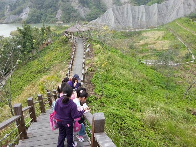
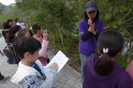
If you want to observe plant ecology and ecological engineering methods, the trails would be one of the best vantage points.
|
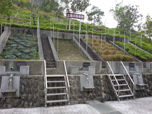
The soil erosion simulation area shows students the significance of soil and water conservation. |
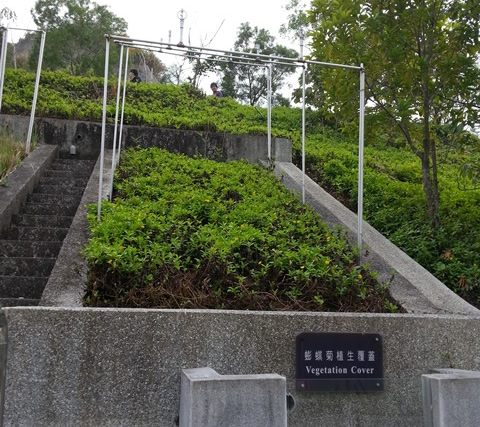
The diagram shows the effect of vegetation cover with Chinese wedelia on soil erosion.
|
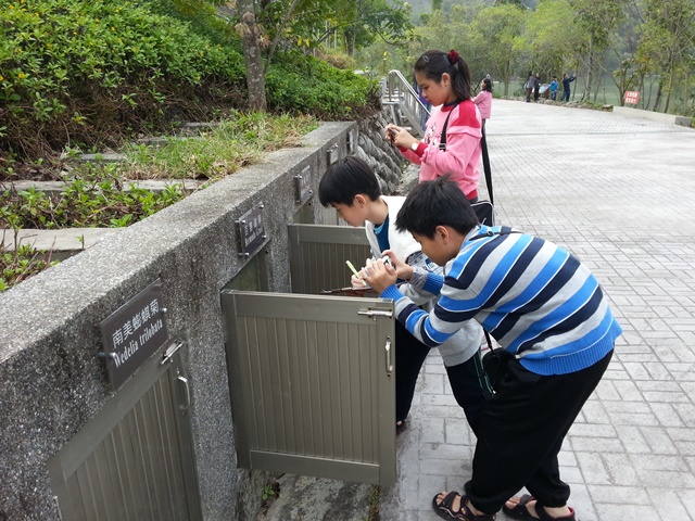
The inspection boxes show how roots of plants grow down into the earth and hold the plants firm in the ground.
|
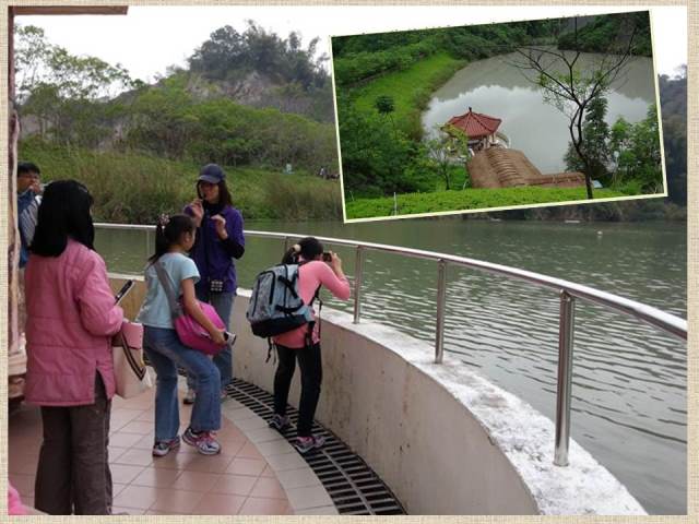
The pavilion in the lake: 12-meter piers stand in the water and support the pavilion which was built even one meter lower than the water level. Those drainage holes help water flow away from the pavilion when the water level is higher than the platform of pavilion and the water flows into the pavilion. The drainage system also can allocate the excessive water to irrigate lands.
|
|