The
Setting Up and Denomination of the Site
The
Setting Up and Denomination of the Site
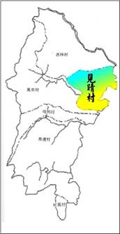
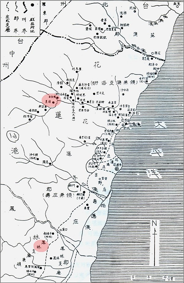
It was named Jianching Tribe and was
subordinated to Fenglin branch under the
Japanese government. In June of 1946, it was
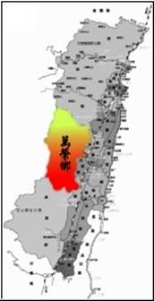
re-subordinated to Wanrong Township and
founded the Jianching village.
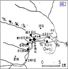
Primary members of this community are from
the Kebayan area, and are descendants of the
Awi family. In June 1914, the Japanese force
occupied the Kebayan area, and established
two occupation offices, one at Kebayan,
which is responsible for the management of
Tongkalo Tribe, Uway Tribe, Luweng Tribe,
Bokabalas Tribe, and Kebayan Tribe; one at
Batonof, which is responsible for the
management of Batonof Tribe and Lubo Tribe.
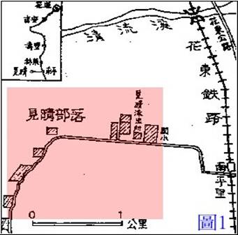
The Japanese police named the site as
“Jianching” due to the height and clear
sight of Batonof. When it was moved to its
current site, this name was adopted as the
name of the community.
Tribal
Migration:
The Kebayan community later was divided into
Kebayan and Uway. The Uway community, led by
Siyup Umaw, migrated out of the mountain and
settled at Qauan of Xiulin Township in
Hualien County. Part of the Kebayan
community also moved out of the mountain to
Truku, Gulu, Daolas, and Jiashan in the same
Township.
The remaining population of Kebayan
increased over the years. Later, led by the
head chief of Lausi Pakul, they moved to the
current site of the Jian Ching Village and
remained there since then.
Kebayan
Area—The Residence of the Awi Family
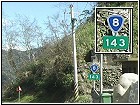
Kebayan Area situated at the plateau below
Central Cross-Island Highway New Aspen
Station (Tai-8 143 km mark). It is a
mountain region of the Liwu River’s branch
Siaowa Hei-er River and Luweng River. To the
east of the Kybayan area is the Mantou Mt.;
to its west is the Central Mountains. The
Awi family’s residence is primarily on
versants near the Kebayan area.
Awi originally lived in Saso (now Chingguan
of Nantou County Ren-ai Township Ching). He
had three sons and a daughter. His daughter
was called Bonga; after the death of her
husband and unwilling to stay in her
husband’s home, she returned to Awi.
Before long, she and her brother Lausi and
Pixo all agreed that, in order to solve the
problem of insufficiency of arable, Lausi
should become the leader of migration and
move to a fertile area. They settled in a
place now called “Shinbaiyang”, which became
the base of the Awi family’s early
development of uncultivated land.
Ulay situates in the southern west of now
Shinbaiyang area, at the slopes of the river
bank of where Liwu River and Luweng River
converges. Surrounded by rivers from three
directions, and faced with a mountain at the
forth, Ulay is an advantageous location
which is easy to defend, and thus a safe
place for residence. When passed on to the
second generation, Ulay no longer had enough
arable for the increased population, thus
the tribe started to migrate to nearby
places.
At the beginning, Payan, a son of
Bonga, migrated to a terrace 1 km east of
Ulay, and founded a new community. Payan was
brave and strong, as well as benevolent, and
was widely respected. As a result, after his
death people call the place where he lived
“Skobayan” for memorial. Later its
pronunciation changed a bit (Kebayan), and
became “Shinbaiyang” now.
Thirty years after the
establishment of the Kebayan community, a
son of Pixo•Nauyi,
Umaw, moved his family to a place 2 km
southern west of his original residence, and
called the place “Batonof”, meaning that
this place has a lot of rocks. In Japanese
occupation, Japanese police renamed the
place for its height and clear sight as
“Jian Ching”, which means “vista”. The
fourth generation after Awi had established
eight communities in the mountain regions of
Kebayan. Each community had its own chief to
govern the community. When enemy attacked, a
supreme chief would be selected to command
the united defense of the enemy.
In June 1914, the Japanese force attacked
Truku. Kebayan area selected the chief of
Kebayan, Uming•Pakul
as their supreme chief to lead fighters to
defend. The battle at Batonox-Daya, slightly
east of Luweng, was especially fierce. The
Japanese force could not overcome them until
they split forces and attacked them from two
directions.
In order to prevent fighters of the
tribe to snipe the Japanese police or to
rise a turmoil, the Japanese government
forced people of the Kebayan tribe, the
inner and outer Truku, and the people from
Btulan to migrate to Wenrong Township, and
gradually founded the current villages
there.
References:
1. Liao, S.C. (1977). ‘The Migration and
Distribution of the East Sejiq of the Atayal
(1), (2)’. Collected Papers of Academia
Sinica Institute of Ethnology, 44, 45.
Figures 1, 2, 3 in Liao (1977), ‘The
Migration and Distribution of the East Sejiq
of the Atayal (1), (2)’. Collected Papers
of Academia Sinica Institute of Ethnology,
44, 45.
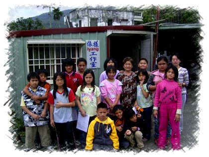
Local
features: studios
Jian Ching community has many studios of
traditional arts. Owner of these studios are
all enthusiastic in traditional handicrafts.
Not only do they preserve the traditional
skill, they also try to promote the
traditional culture. Classes on traditional
culture in the school depend on the
knowledge of these professional craftsmen.
Uhai Studio
Owner: Ce-mei Hu (Uhai)
Introduction: Specialized in the
craftsmanship of Truku traditional weaving
and rattan tools; expert in traditional
weaving.
Iyang Studio
Owner: Hui-fang Wu Chung (Iyang)
Introduction: Specialized in the
craftsmanship of Truku traditional weaving
and rattan tools; expert in traditional
weaving.
Uma Leather Carving Studio
Owner: Uma
Introduction: Their leather productions
integrated cultures of various tribes. Works
blended with totems and leather carving show
distinctive tribal styles.

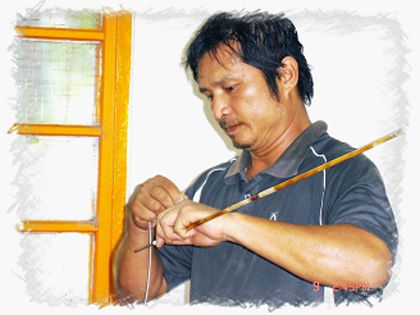
Guang Nan Bow & Arrow Studio
Owner: Guang-nan He
Introduction: Specialized in hand-made
traditional Truku bows and arrows, provides
archery fans from inside and outside the
township for practical use or collection. In
order to keep the quality of their products
high, their amounts are limited and must be
reserved.
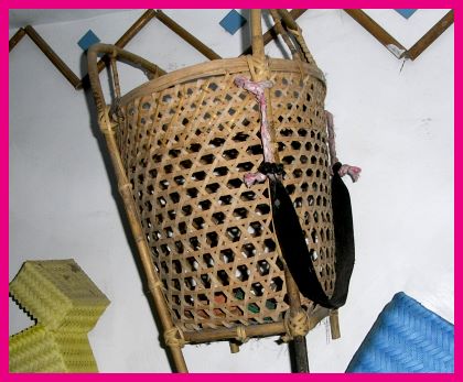
Simple Ramie Back Basket
Owner: Rong-fa Li, Jin-de Chiang
Introduction: The Simple Ramie Back Baskets
they produced are characteristic.
References:
Hualien County Wanrong Township
website—Office Introduction—Village Office—Jianching
Village (2008.02.03)
http://www.wanrung.gov.tw/officesintro/village_jc.aspx