Geographical Distribution of the Forty-Four South Village
The Forty-fourth South Village was constructed as row houses along the south margin of the Forty-fourth Arsenal for the military dependents’ families. It existed because of the Forty-fourth Arsenal, so we should first ascertain the location of the Forty-fourth Arsenal. As 44 Arsenal took over Japanese Army Depots, according to the Taipei map drawn in 1945 by the US Military, the depots were clearly marked in the trapezoidal area bounded by the present Keelung Road, Chunghsiao East Road, Xinyi Road, and Hulin Street. In addition, we can see a railroad branch line (Sanchanli branch line) specifically for the shipments of the Arsenal-made ammunition.
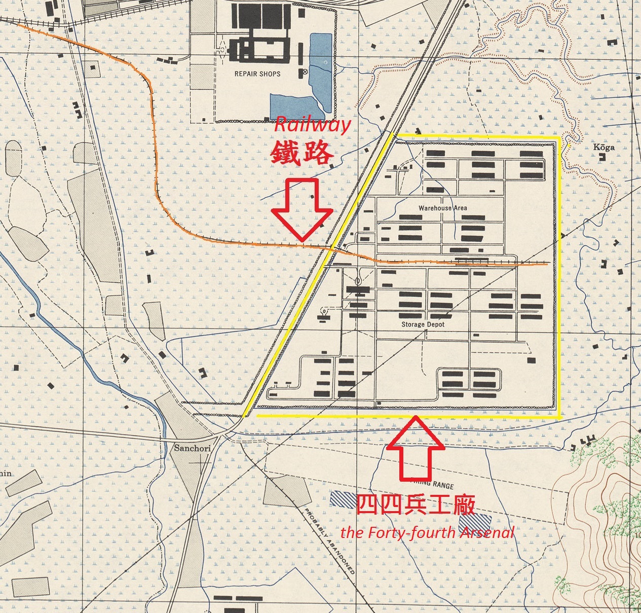
1. The range of the Forty-fourth Arsenal and the railway branch lines through the Arsenal (marked with yellow lines) are displayed in Map of Taipei, drawn by the US Military in 1945
Source of data: Taiwan Map, drawn by the US Military, Library of University of Texas at Austin
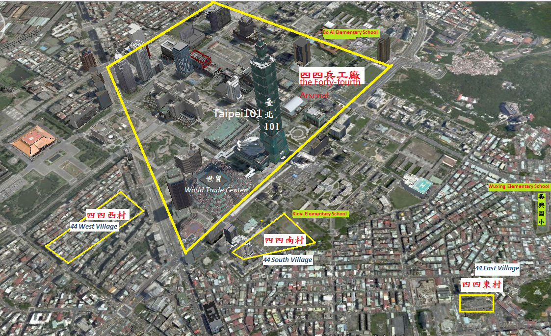
2. The relative location map of the original 44 Arsenal, 44 South Village, 44 West Village, and 44 East Village (marked with yellow lines)
Source of 3D map : Google maps