Home>>Youchang>>Geographic
Geographic
Geographical Kaohsiung
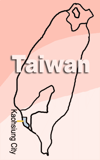
‘Kaohsiung’ is situated on the southwestern coast of Taiwan, facing the Taiwan Strait to the west and, beyond the southern tip of the island, the Bashi Channel to the south. It sits across vital sea-lanes connecting Northeast Asia with the indian Ocean, and offers outstanding commercial port facilities.‘ To welcome the World Games 2009 in Kaohsiung’, Kaohsiung City government has lunched a series of construction projects, expecting to build an “ocean capital city.”

Geographical Youchang
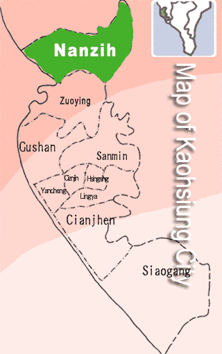
The map of Youchang, Nanzih District.
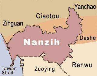
Nanzih District lies in the northest of Kaohsiung City. Nanzih District is devided into three regions:Youchang, Houjing and Nanzihkeng. When Japan colonized Taiwan, Youchang had just 5 li(a basic unit of city administration, it is smaller than district), but now it has been expanded to 17 li. Its history can be traced back to the earliest Chinese immigrants in Kaohsiung.
Vital Statistics
- Area:7.3891 square kilometers
- Population:69663
- Bibliography
- ◎Nanzih District Office, Kaohsiung City
http://w4.kcg.gov.tw/~nantz/index.php?strurl=main.htm - ◎Teaching material of native soil:Love ours community, Nanzih District, Kaohsiung City.
http://http://takau.kh.edu.tw/%B7R%A7%DA%B0%AA%B6%AF/ks/ksa04/a04.htm - ◎Bureau of Cultural Affairs Kaohsiung City Government
http://www.khcc.gov.tw/CmsShow.aspx?ID=656&LinkType=3&C_ID=445 - ◎Environmentally friendly temple, Yuan-Shuai Temple.
http://library.taiwanschoolnet.org/cyberfair2004/koch222/home.htm - ◎Wikipedia:The location of Nanzih
http://zh.wikipedia.org/w/index.php?title=Image:Nanzi_District_Location.PNG&variant=zh-tw