
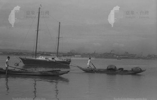
Shezi Island is located at confluence of the Keelung River and the Danshui River. It developed natural river transportation by boats.
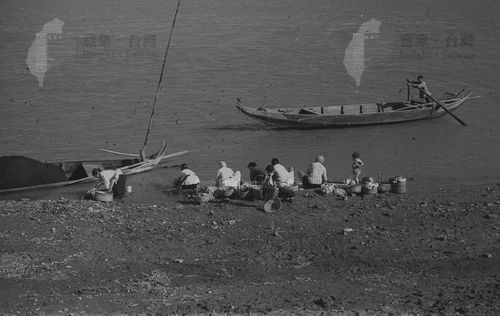
Shezi Island is a sand bar island surrounded by Danshui River and Keelung River. In the past, land transportation was not developed. It was mainly dominated by water transportation. In addition, after the opening of the port in the Qing Dynasty, the boats sailed from Huwei (Danshui)to Dadaocheng, Mengjia must pass Shezi Island.Shezi Island is also a rest stop in the middle route. At that time, the main villages had boat routes heads for people to take to the opposite bank, and barges carrying pedestrians and cargoes busyly shuttled across the river; sometimes duck-raising families were commanding groups of people on the ship. Ducks are foraging on the river; or seeing boats carrying water and fertilizers entering the inland ditch, preparing to fertilize farmers by the farmland, so that the vegetables grow bigger and better; there are many people waiting at the head of the open boat in the Qingming season To take a boat to the ancestral tomb on Guanyin Mountain to scan the grave; accompanied by the women talking and laughing on the river bank, the babble of children playing on the river bank, the paddling of boatmen, the scream of workers carrying goods, and the distance The howling ducks and the murmurs of big and small birds were heard. At that time, the bank of Shezi Island was lively and full of vitality.
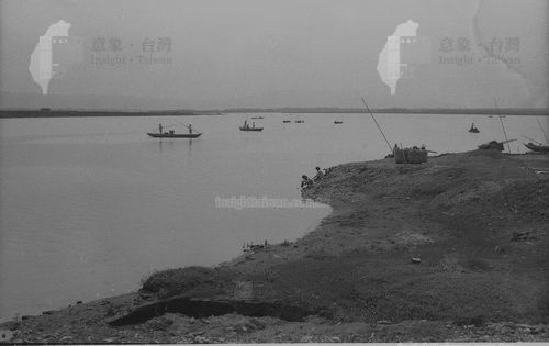
Early shipping on Tamsui River(Guandu to Tamsui)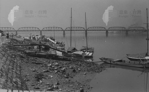
Shipping at DadaochengQyay
Quay scenery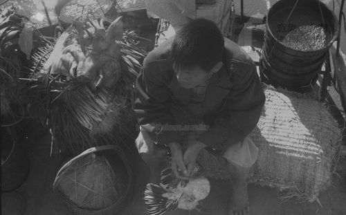
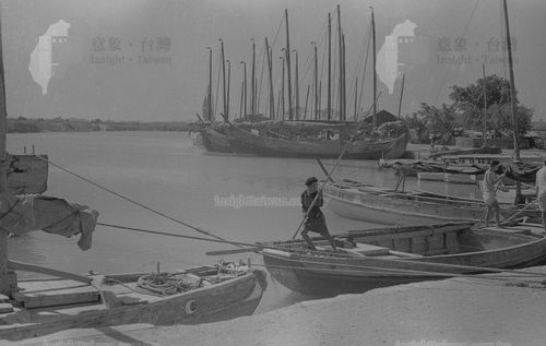
Traveler and cargo on the open boat
Laundry woman and boatman on the bank of Tamsui River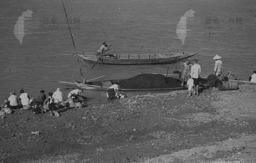
Open boat on the Keelung River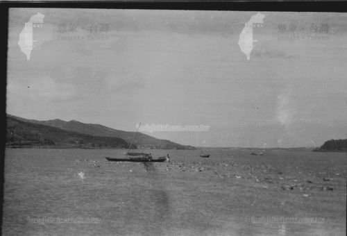
Duck boat on the Tamsui River
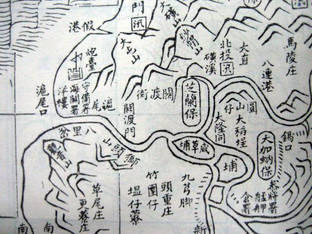
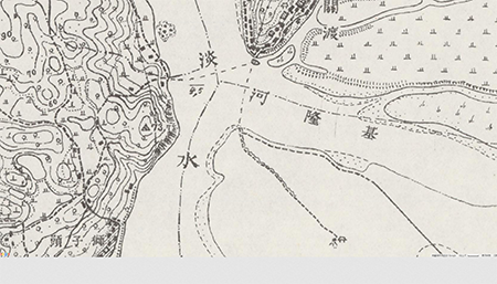
During the Japanese rule (topographical map of 1921), there were four routes in Shezi Island, namely the Xizhoudi to Louziyu route, Zhongzhoupu to Shuihu route, Fushan to Guandu and Lionhead route, and Fuzhou to Baxian route.
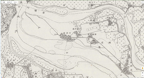
Open boat route map (1921)
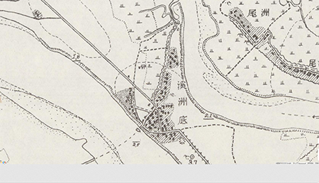
Xizhoudi to Luzhou cycle route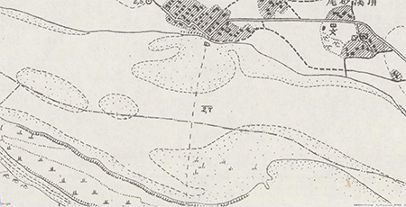
Zhongzhoupu to Luzhou cycle route
Fushan to Guandu and Bali cycle route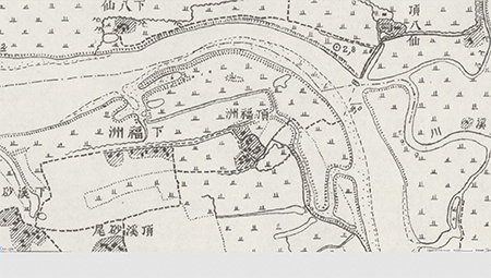
Fuzhou to Baxian cycle route
The old Mr. Bifeng Chen, who was at the Xizhoudi, mentioned that in the old days, Shezi Island had a hard life. It was mainly planting vegetables and rice. , Is a wooden boat of short and wide type. Because land transportation was not convenient at that time, they were mainly waterways, so there were many types of boats, such as transporting water and fertilizer, vegetables, people, and even coffins. There were three docks on the waterway of Shezi Island at the time: Xizhoudi, Fuzhou and Zhongzhou. Among them, the agricultural products in Xizhoudi, Zhongzhou and other places are shipped to Taipei and Banqiao markets; Fuzhou is shipped to the Beitou market on the other side.
Ms. Bie Wang of Fushan also said that the residents of Shezi Island used to rely on boats as a means of transportation to go to work and carry vegetables. Early ships did not have motors and could only paddle with their hands. Early in the morning, the busiest is the riverside. What impresses me most is that when encountering heavy fog, some people will row in a row and get lost. As a result, they return to the shore when they started. It makes people laugh! At that time, there were more than 20 ships on the river. If a typhoon struck, regardless of the three or seventy-one, the owner could move the ship as fast as possible to fix it in a safe place, so that it would not be blown away by the typhoon.
According to the "Shilin Chronicle" of the Taipei City Government, the Shezi Suspension Bridge in Hougangli, Shilin was completed in 1939, which was the only way to the outside of Shezi Island at that time. In the early days, open boats were used. Yanping Bridge opened in 1962. The Bailing Bridge was opened in 1967. Shezi Suspension Bridge was over-restricted and was demolished around 1981. It can be seen that with the improvement of the land transportation construction in the surrounding area, the water transportation in Shezi Island has gradually disappear.
Reference source:
Center for GIS, RCHSS, Academia Sinica. "Centennial History Map of Taipei." [Online] http://gissrv4.sinica.edu.tw/gis/taipei.aspx
Shezi Island Aesthetic Association."Interview with celebrities in Shezi Island.", 2007.
Taiwan e-Learning & Digital Archives Program. "Business photo gallery and amateur works during the Japanese rule." [Online] https://catalog.digitalarchives.tw/Organization/List.jsp?CID=58636

- Teacher Shezi Island let us see some pictures of Shezi Island, plus the description of the above text, it feels that Shezi Island was vivid in front of us in the old days. This is a precious experience. Maybe my dad does n’t know that there is this picture Well, I really want to go home and share with him. Through this webpage, I have the materials. (PO-XUAN)
- 1. In the past: Most people took vegetables to go out to sell, and relatively few cars. So this ferry head is to make it easy for them to board the boat and to let the boat have a docking place, so this ferry head is very important. Without this place, Shezi Island would have no economic ups and downs, and it would also be a tourist attraction, where many people would observe the ecology. 2. Now: Most of them are entertaining. Whenever there is a holiday, someone will take a cruise to our Shezi Island for sightseeing, and observe some of our unique ecology. Many people come every holiday, and the ferry is crowded. It's full, we often can't get in when we go cycling, so this is also an important boat entrance.(ZHAN-YI)