|
|
|
|

|
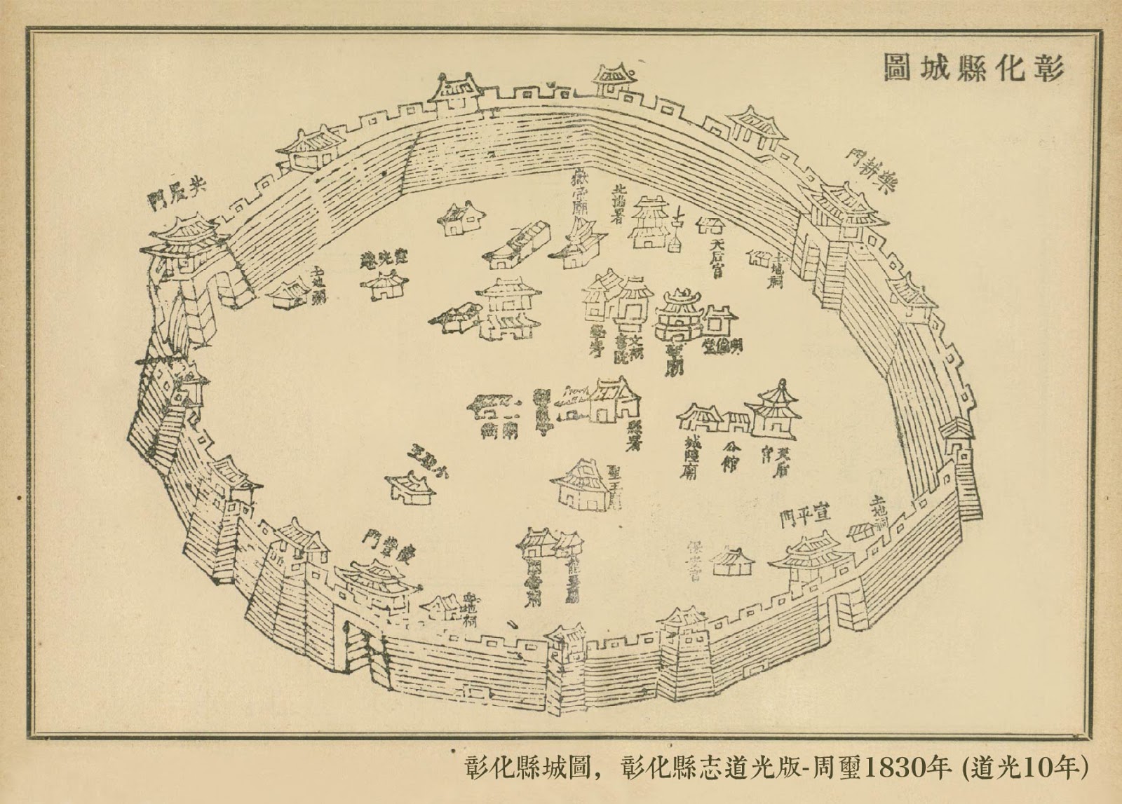
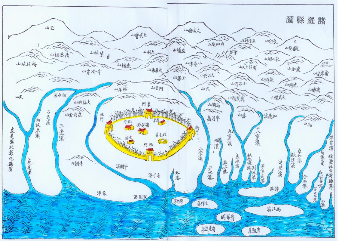
One: the speech said Zhanghua
Zhanghua is a historical site
city, initially called clear
“half line”, subordinates Zhuluo
County, the ancient geographic
name “half line” is picked from
the Pingpu ethnicity “half
society” the pronunciation
translation; Afterwards changed
“Zhanghua” the city, the Qing
Dynasty government is “reveals
clear the emperor” meaning of
the policy; In addition, “half
line” society occupies
originally, because of at that
time Fujian governor Wang
Shaolan, in constructed in the
county stele inscription, had
“guarantees the city to
guarantee sentences and so on
people 'clear' saint emperor
great prosperous sea islet 'of',
Yu Riju the time then renames
Zhanghua”.“The sulphur brook”
was in addition represents the
local culture as for to be
prosperous, set up the Zhanghua
people fair and just “the
sulphur brook spirit”
The Kanghsi 23 years, the Fujian coast inhabitant will
travel to the east one after
another the reclamation, Yong
Zheng first year the beginning
among Zhuluo County hundred mile
lands supposes for the county
seat, the winter solstice tiger
tail, north will arrive at
Tachia, from this time on will
only then call Zhanghua.Because
the close mainland, must flush
take Lugang as the trade, when
then becomes this county
politics culture, the commercial
main center for center
Zhanghua.After Guangxu 21 Japan
establishes a separatist regime
Taiwan, Zhanghua changes
Taizhong County Fenmgyuan,
latter changes the Zhanghua
hall, Xuantong Period first year
merges in the Taichung hall,
changes in the platform a hall,
in 1920 changed subordination
the Zhanghua county - to be
called Zhanghua.
|
|
|
|
|
|
|
 |
|
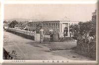
Two: administrative
regionalization
Zhanghua (Japanese: Zhanghua/し
ょ
う
か
し), was
administrative area of the
existence during 1933~1945 in1933 during ~1945 years, governed is the
Taichung state, now Zhanghua
County Zhanghua.By the Zhanghua
street, south the Guozhuang, the
big bamboo village merge sets
up.
|
|
|
|
|
|
|
|
|
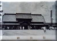
Three; Zhanghua history
Taiwan
governs the last stage solstice
to govern the initial period,
Niu Chouzi the area is a street
village clear, which is called
“Niu Chouzi the village”,
subordinates east the line the
fort.North this village with
Arab League yi Zhuang Weilin,
east encircles Zhuang Weilin
with the big bamboo, the south
side for the south entrance
village, nearby the southwest is
the Zhanghua street, the west
side for the west potential
whelp village, the Xinzhuang
whelp village.
In 1901
(date governed the Meiji for 34
years) in November, this village
subordinated in the Zhanghua
hall. In 1909 (the Meiji 42
years) in October, changed
subordination belongs to the Taichung hall. In 1920 (Taisho nine years), this
village changed the system and
changes name as “Niu Chouzi” the
large brush-written Chinese
character, subordinated in the
Taichung state Zhanghua county
big bamboo village, under the
large brush-written Chinese
character has “Niu Chouzi”, “Zhuang-zi”,
“under Bu”, “the foot of a hill”
the small character name. In
December, 1933, south the Zhanghua street merge the Guozhuang, the big
bamboo village, the promotion
became Zhanghua. Postwar
Zhanghua subordinates in Zhanghua County,
the large brush-written Chinese
character also changes the
system for in. It is good for
the urbanization development. |
|
|
|
|
 |
 |
|